

Mealaisbhal [Mealisval]
Good walks are even better shared.
NB0227 : Mealisbhal
Philip Photo source
Overview
Exploring Mealaisbhal [Mealisval]
Overview
Mealaisbhal, at 403 meters, may not be the highest peak in the Outer Hebrides, but it stands tall with pride, offering a memorable hike for those who tackle it. Classified as a Marilyn, it's a fantastic choice for both seasoned walkers and those looking to dip their toes in the rugged beauty of Scotland.
Getting There
Accessing Mealaisbhal is convenient via the West Loch Roag Route. Take the local roads from Stornoway, and follow signs towards the loch. Remember, it's best visited in spring or early summer when the paths are drier and the views are spectacular.
The Hike
The hike encompasses a pleasant 5.5 km distance, taking about 3 hours to summit if you're in decent shape. The terrain is a blend of rocky outcrops and gentle grassy slopes, peppered with the occasional bog that could prove a little surprise. Along the way, savour the views as they steadily improve, giving you a taster of what’s to come at the top. Trust me, your knees will thank you for being in shape after this!
Summit Features
As you reach the summit, you'll be greeted by a charming little cairn, perfect for a victory photograph. The far-reaching vistas of the surrounding islands unfold like a well-drawn map, beckoning you to explore further.
Flora and Fauna
The vegetation here is typical of the Hebrides, showcasing hardy grasses, heather, and perhaps a few cheeky wildflowers that defy the harsh conditions. Look out for local wildlife, potentially including golden eagles soaring above and familiarised sheep grazing below.
Hazards
While the ascent is reasonably straightforward, do keep an eye on the weather. Conditions can change quicker than a squirrel on a sugar rush, and those bogs might just swallow your boots if you're not careful. Better safe than soggy!
Nearby Attractions
Don't miss the chance to check out nearby summits like Eaval and Bheinn Mhor that provide endless exploration opportunities. Each peak has its charm and unique views, so bring along your adventurous spirit!
Conclusion
Mealaisbhal is not just a hike—it's a journey through time, landscape, and culture. Whether you’re standing atop to enjoy the sweeping views or to simply have a moment of peace, it’s a hike well worth the effort.
So pack your lunch, grab your walking boots, and perhaps a friend to share the adventure (and the snacks!) and make your way to this piece of Hebridean paradise. Enjoy every step!
Explore routes near Mealaisbhal [Mealisval]
Walks starting near this hill. Open a route to check its map, distance and full itinerary.
Beautiful private beach walk Isle of Harris
View route
Berneray Community Hall to the beautiful beach
View route
Route planning notes
These notes describe possible approaches. Check a route's map and access information when planning your walk.
West Loch Roag Route
A scenic and moderately challenging ascent from the shores of West Loch Roag, offering stunning views along the way.
Make a day of it, together
Find someone to share the walk with, or organise a day out along a route you like.
Photo Gallery
View all Photo could not load
NB0227 : Mealisbhal
Philip
 Photo could not load
NB0227 : Mealisval summit cairn
David Purchase
 Photo could not load
NB0227 : Sunset behind Mealaisbhal and the hills of Tamanabhaigh
Philip
Hill facts and local notes
Classifications
Elevation
574m
1,883 ft
Prominence
516m
Coordinates
58.1316, -7.0612
NB022270
OS Map
13
Explorer: 458
At the Summit
The summit features a modest cairn and offers a panoramic vista over the surrounding islands. It's a great place for a breather and a snapshot that will make your mates envious.
Terrain & Geology
The underlying geology is dominated by Lewisian Gneiss, one of the oldest rocks in the UK. This ancient formation offers a glimpse into the planet's distant past.
Views & Scenery
From the summit, you can see the Isles of Lewis and Harris, the deep blue of the Atlantic Ocean, and the rugged beauty of the surrounding landscape.
History & Heritage
Name Origin
The name 'Mealaisbhal' is derived from Gaelic, meaning 'the top of the hill or mountain'. A bit of a no-nonsense name, really!
Historical Significance
The area is rich in Gaelic culture and history, with stories of the land and its people woven into the very fabric of the mountains.
Getting There & Facilities
Parking
There is a small car park at the West Loch Roag access point, with space for around 5 cars. Arrive early to nab a spot!
Public Transport
Buses run from Stornoway to various spots across Lewis, but check local timetables as they may be sparse, especially on Sundays.
Nearby Facilities
Cafes and toilets are available in nearby Tarbert, about 18 km from the parking spot.
Safety Information
Known Hazards
- Be mindful of sudden weather changes, as conditions can shift quickly in the Outer Hebrides. Also, watch out for boggy areas that can swallow a boot whole!
General Safety Tips
- Check weather conditions before setting out
- Carry appropriate clothing and equipment
- Let someone know your planned route
- Take a map, compass, and GPS device
- Carry emergency supplies: food, water, first aid kit, torch
Hills
Some common questions about the hills answered
Are there group walks up Mealaisbhal [Mealisval]?
Many walkers use Walkmates to join or organise walks with others. You can check for group walks around Mealaisbhal [Mealisval] through the maps
Are there other walkers around Mealaisbhal [Mealisval]?
Activity varies by location and time, but Walkmates lets you see whether others have shared walks or shown interest in this area. Find other people through the walking friends search walking friends for Mealaisbhal [Mealisval] search or of course create your own walk for Mealaisbhal [Mealisval]
Can I organise a walk to Mealaisbhal [Mealisval]?
Yes. If there aren’t any walks listed already, you can create a walk and make it available for others to join.
If you're signed up to Walkmates, you can create a walk to Mealaisbhal [Mealisval].
How do I find a walk up this hill?
There are often multiple ways to walk this hill, depending on experience and route preference. Walkmates helps you explore walks and routes that others have shared.
Can I suggest a new route up Mealaisbhal [Mealisval]?
Yes. You can suggest or create routes to share with others. Walkmates focuses on the social side of walking, so routes are used to help people organise walks and explore areas together, rather than as detailed navigation tools or route libraries.
Other uses really appreciate knowledgeable walkers sharing their routes. Share your favourite route to Mealaisbhal [Mealisval] here
The is an error or something incorrect about this hill. How do I let you know?
We always strive to keep the information on Walkmates as accurate as possible. If you find an error, please let us know through the contact form and we'll aim to correct it as quickly as possible
Community Discussion
Comments
Location
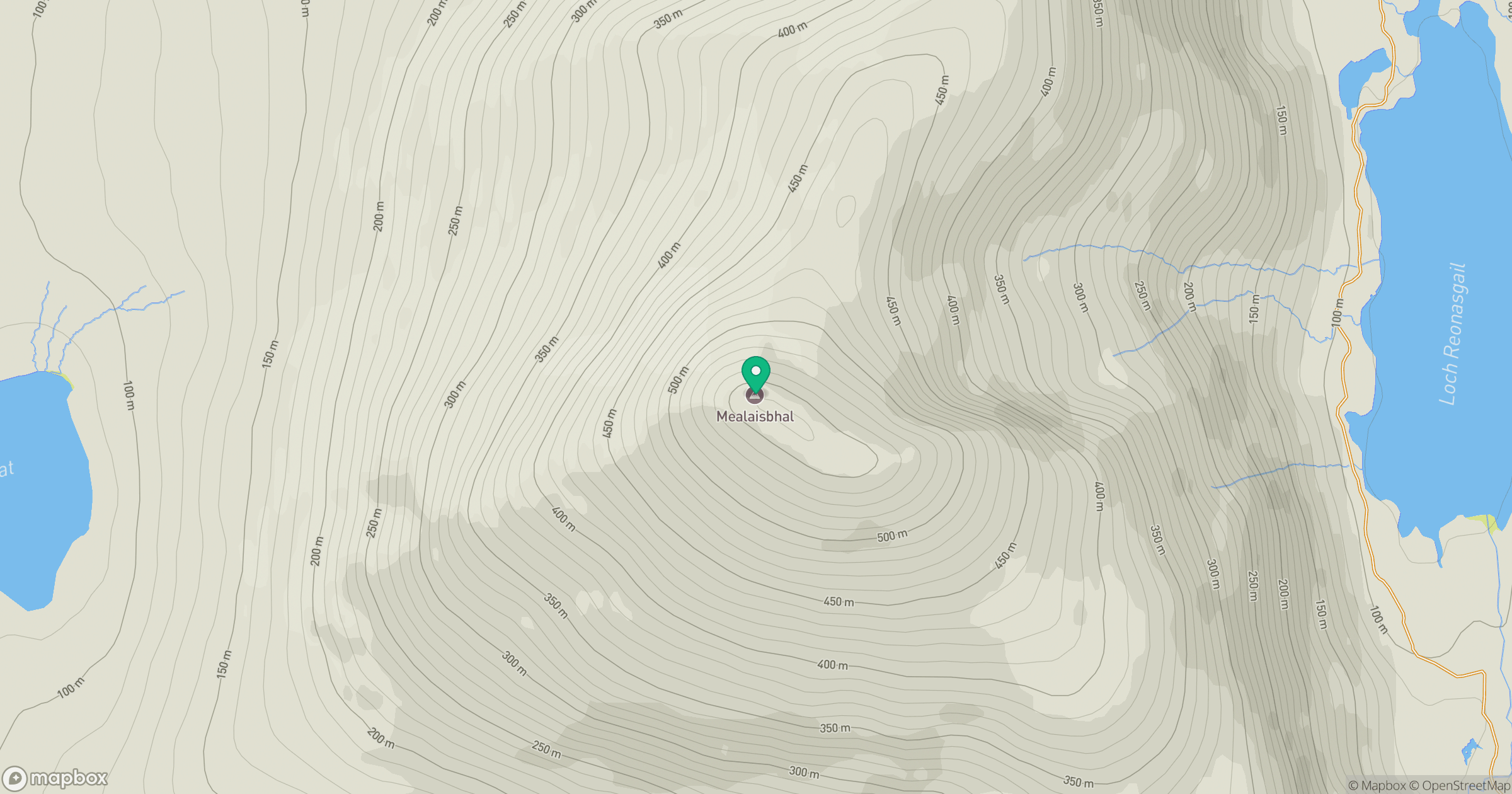
Grid reference: NB022270
View on OpenStreetMapOpens a map in a new tab, centred on the hill.
No comments yet. Be the first.